The sky pond trail colorado route is one of Rocky Mountain National Park's most memorable day hikes, but it is not a casual walk to a viewpoint. From the Glacier Gorge Trailhead, the path climbs past Alberta Falls, The Loch, and Timberline Falls before reaching Sky Pond beneath Sharkstooth and the surrounding granite walls. The numbers look manageable: roughly 9.4 miles round trip and about 1,780 feet of gain. The altitude, wet rock, crowds, and afternoon weather make the day more serious than those figures suggest.
I like this trail because it changes character several times. The first miles are a forested approach beside Glacier Creek. Then the trees thin, the water becomes louder, and the route asks for more attention. By the time Sky Pond appears, the ordinary rhythm of walking has given way to small decisions about footing, pace, and whether the clouds are moving in faster than expected.
Route details and what the miles feel like
The trail begins at Glacier Gorge, a small lot that fills early in the day. The opening section is steady rather than steep, with roots, rocks, and occasional muddy patches. Alberta Falls arrives quickly and can feel crowded, especially during the first hours of daylight. Keep moving unless you genuinely want the short detour; the quieter parts are farther up the drainage.
Beyond Alberta Falls, the route continues toward The Loch. This broad subalpine lake is a useful mental checkpoint and a reasonable turnaround for anyone feeling the altitude. The trail remains obvious, but footing becomes less uniform. Water crosses the path in places, and late-season snow can linger in shaded sections. Trekking poles are useful here, not because the terrain is extreme, but because they reduce the cost of every small correction.

From The Loch, continue toward Timberline Falls. This is where many descriptions become too casual. The final approach is steep, wet, and rocky. Depending on conditions, you may use your hands for balance while climbing beside the falls. The rock can be slick, and a slip here has consequences. Give descending hikers room, keep your pack secured, and do not rush because a group is waiting behind you.
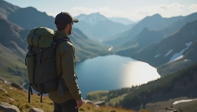
Above the falls, the trail reaches Lake of Glass before continuing to Sky Pond. The final basin is enclosed and still, with broken granite rising around the water. Sharkstooth is the feature most people remember, but I often remember smaller things: wind pressing against the lake, the smell of wet stone, and the way conversation drops when everyone realizes the route has arrived at its quietest place.
Timing, permits, and getting an early start
For the sky pond trail colorado hike, start earlier than your appetite for sleep suggests. Parking at Glacier Gorge is limited, and Rocky Mountain National Park uses timed-entry procedures during the busy season. Reservations, road access, and shuttle arrangements can change, so confirm current requirements through the park before leaving home. Do not build a plan that depends on finding an open parking space at midmorning.
A dawn start has practical advantages beyond avoiding crowds. It gives you cooler temperatures on the climb, more time to move carefully above Timberline Falls, and a larger margin before afternoon thunderstorms. In summer, I would rather reach the upper lakes early and watch the sky than arrive late with a beautiful forecast already unraveling. The route is not a race. It is a sequence of small choices made before fatigue gets a vote.
Allow five to seven hours for a steady round trip, more if you take photographs, wait at the falls, or move cautiously over wet rock. Strong trail runners may finish sooner, but speed does not remove exposure or weather risk. The return trip deserves attention. Tired legs are most likely to slide on the descent beside Timberline Falls, when the mind has already shifted toward the parking lot.
Weather, altitude, and the decision to turn around
The sky pond trail colorado route climbs from roughly 9,200 feet at the trailhead to about 10,900 feet at the lake. A visitor coming from lower elevation can feel that change through a faster pulse, a dull headache, or unusual breathlessness. Slow down early. Drink normally, eat something with salt and carbohydrates, and treat persistent or worsening symptoms as a reason to descend.
Lightning is the hard boundary. The upper basin offers little shelter, and the granite around Sky Pond does not make a storm safer. If thunder is audible or dark cells are building west of the Continental Divide, turn around before the final climb. You do not need to defend that decision to anyone. A photograph is replaceable; a hurried descent through exposed terrain is a poor trade.
Snow and ice can remain near Timberline Falls well beyond the first warm weeks of summer. Microspikes, traction, and an ice axe are not interchangeable tools, and carrying equipment does not mean you are prepared to use it. If the route is frozen and you lack the skill to manage it, choose a lower trail. Conditions can change between a sunny trailhead and a shaded waterfall.

What I would carry
For a dry summer day, sturdy trail runners or light hiking shoes with dependable wet-rock grip are enough for many experienced hikers. I would add trekking poles, a rain shell, insulating layer, sun protection, and more food than the mileage appears to require. A small first-aid kit should include blister supplies, because a hot spot at mile two can become a serious problem on the descent.
Carry water and a filter or treatment method. The drainage is not a promise of clean drinking water, and popular sections receive heavy use. A capacity of two liters is a sensible starting point for many hikers, adjusted for heat, personal needs, and the availability of reliable sources. Bring a map downloaded for offline use; cell service is not a route-finding plan.
Leave the cotton hoodie at home if the forecast is unsettled. A light synthetic or wool layer, protected from rain in a pack liner, gives you more options when wind rises at the lake. The right kit is not the fanciest kit. It is the collection of ordinary pieces that still work when you are wet, tired, and making decisions with cold fingers.
The quieter way to experience the trail
The best version of the sky pond trail colorado day is not necessarily the one that reaches the lake first. Start early, move steadily, and let faster groups pass where the trail allows. At Sky Pond, step away from the landing area if conditions permit, keep food secured, and give the place a few unphotographed minutes. The mountains do not need your performance.
If the parking lot is full, the weather is deteriorating, or Timberline Falls feels beyond your comfort and skill, turn back. The Loch is still a worthwhile destination, and Alberta Falls is not a consolation prize. Good route judgment often looks ordinary from the outside: a quiet change of plan, a snack eaten in the trees, a return to the car with daylight left.
Plan the sky pond trail colorado route with enough margin to be patient. Check the park's current access rules, study the forecast, and leave an itinerary with someone at home. Then walk it one steady step at a time.



No comments yet — grab the first one.